
View from Valencia School Rd summit Since I had the day off, I decided to try to climb Eureka Canyon in under 45 minutes. My previous best was 51-52 minutes, but I had stopped for about 5 minutes during the climb to loan my pump to a woman with a flat. I also decided to take Valencia School Rd, as I had only ridden it once before, over a year ago, and it was on the way to Corralitos. It was a cool and cloudy day, without any wind. I felt pretty strong throughout the ride.
Since I got up late, I got started pretty late, at 10:30. That might have contributed to feeling pretty strong today. There was a lot of traffic on Soquel, which, being a weekday, was much more than I was accustomed to, as I usually only ride on Soquel in the mornings on weekends. The traffic was exacerbated by road work that closed the right lane and the last half block of the bike lane, before it disappeared anyhow after Morrissey. Then, on the descent to Capitola Rd, I held up because a skateboarder was in the middle of the right lane, and I knew that skateboarders make erratic lateral movements. After he made an erratic zag to the right, I went by him. Between downtown Soquel and Park Ave, there was a pickup truck with horrible exhaust pipes the went up behind the cabin like those on semis, and it spewed heavy, smoky air pollution that was vile. At Aptos, I was glad to make the left turn onto Trout Gulch, getting away from the traffic.
Usually, I'd bear right at Valencia. This time, I went left to stay on Trout Gulch, and, a ways later, I took the right onto Valencia School Rd, a rough one-lane road that had some short, steep climbs. The tree lined scenery reminded me of Bean Creek Rd, but the short, steep, windy, one-lane climbs reminded me of Rodeo Gulch. At the summit, by the intersection with Fern Flat, I stopped to take a picture. The descent back to Valencia reminded me of the one-lane parts of lower Mtn Charlie. I took the usual Day Valley and Hames to Corralitos. The climbs felt easier than I remembered from earlier.
View from Highland Way It was 11:52 when I checked the time at Corralitos. The signs saying the road was closed in 10 miles was still there. After the Venture Valley sign by Tindall Ranch Rd, I started going a little harder, as I was feeling pretty strong. I continued riding harder than usual all the way to the top. I suspected a slight tailwind at the time, but, on the other hand, I didn't feel like I was riding into a headwind later on the descent down Soquel-San Jose. When I made it to the end of Eureka Canyon, it was 12:35, so I did it in under 45 minutes. The ensuing descent down Highland was cold, but not really chilling, under the tree cover. A little before the place where the slide had closed the road last spring, I stopped to take a picture.
I stopped at the Summit Market for a lemonade and a break. Unlike just about every other time I stopped there, which, admittedly, were during weekends, there were no other cyclists. In fact, I had seen very few cyclists up to this point. There were the usual commuters heading up to UCSC and a scattering of transportational cyclists in town. There was also a trio on hybrids, one of them walking, climbing Day Valley. There was also a handful of mountain bikers on Highland Way.
After finishing the lemonade and half a bar, I headed down Soquel-San Jose. I couldn't help thinking that this is the easiest descent ever. I just shift to the big ring and pedal without touching the brakes until the Laurel Glen intersection, where I headed over to Branciforte.
Since it had been months since the last time I had climbed Glen Canyon, I decided to turn there, and head to Scotts Valley, and, from there, to Felton. As I was clucking as some of the chickens on the right, a descending cyclist passed by, waving. Glen Canyon is a very familiar climb to me, even though I hadn't ridden it very often since 2003, as it was part of my daily commute from 1999 to 2003, so I must have climbed and descended it close to a thousand times. When I got to Mt Hermon Rd, it was back to heavy traffic, but not more than usual, and I headed down to Felton.
I also wanted to someday climb Felton-Empire in under 30 minutes, but I didn't think I would do it today, so I didn't really try or keep track of the time. Just before the final steep pitch before the spot where the mountains shift from being on the left to being on the right, a descending cyclist zipped by, and we exchanged waves. I was still feeling pretty strong, so I started riding harder at the upper part of the climb where there weren't any steep parts. I didn't know what my time was at the time, but I had a new personal best of under 32 minutes.
There were a few more cyclists climbing Empire Grade. There was one on a road bike zooming down to the local minimum at the Smith Grade intersection. There were a number on mountain bikes after the Chinquapin trail intersection.
As I approached the final descent marked by the 8-14% grade sign, a pickup with a horse trailer was gaining on me from behind, so I pushed harder on the descent and left it behind on the turns. It caught back up to me near the top of the following short climb, and passed me when the bike lane appeared by the UCSC west entrance. I think I made a new personal best on that descent, even though I braked more than usual going into the turns.
Wednesday, November 22, 2006
22 November 2006
Saturday, November 18, 2006
18 November 2006
 Low-Key Hillclimb: Page Mill
Since the club ride this week was in San Francisco, I decided to try this week's Low-Key Hillclimb. It would be the second time ever that I climbed Page Mill. It was about a 50 mile ride to the start, and registration was from 9 to 9:45, so I got going at 6, when it was still dark outside. I knew it would be cold on Hwy 9 through the San Lorenzo Valley, so I had gotten new shorts and leg warmers, and they were effective. The cold was mostly a problem for my hands, so maybe I should have gotten gloves as well.
It was cold and dark on Hwy 9 to Felton, and I was also blinded from time to time by the headlights of cars. By the time I reached Felton, the sky had lightened considerably, but, being in a valley, I wouldn't get any direct sunlight until after considerable climbing. At Boulder Creek, looking at the tree covered mountains to the west, I could see that the sun was shining on the upper part, but the lower part was in the shadow of the mountains to the east. A little ways above the intersection with upper Hwy 236, I felt the warmth of direct sunlight for the first time.
As I approached the intersection with Skyline, there were cones and signs warning of runners on the right side of the road. There were two or three people walking along the cones. I wonder what that was. I continued past Skyline and descended towards Saratoga. There seemed to be more car traffic headed up than usual. I was descending fast enough that no cars overtook me from behind. I also saw the first cyclist of the day climbing Hwy 9, as there were numerous cyclists climbing as usual. I turned off at Pierce, then took Mt Eden, Stevens Canyon, Foothill, and Arastradero to the registration site at the Page Mill Park and Ride.
I arrived around 9:15, with plenty of time to spare. I registered for the climb, and got assigned number 143, and would be starting 22nd, 7 minutes after the first rider. This was going to be an individual time trial, with riders starting at 20 second intervals. As I waited for the start, numerous groups of cyclists passed by on Page Mill, including a huge peloton. We then headed to the start site, where the first rider would start off at 10. In the climb, lots of riders, maybe around 20, passed me. I passed maybe one or two. There was a photographer a couple miles from the top taking pictures of all the riders, as well as a photographer at the top. About 2-3 miles from the top, I started feeling weak and low on energy, as I only had half a bar since breakfast, which was about five hours earlier. I limped to the top, and my time was probably in the 50-52 minute range.
Fire engine After some rest and an orange flavored drink, I headed south on Skyline to the fire station, where I got a Sprite and had a bar. I also realized that I hadn't taken any pictures yet, so I took one of the fire engine, which was atypically parked outside of the garage. I also refilled my bottle.
The top of Hwy 9 still had the cones on the east side of the road, and there were still people walking by the cones, so whatever that was was still going on. After that, it was a rather uneventful descent down Hwy 9 all the way back to Santa Cruz and home. It was considerably warmer than it was in the morning, and it was shaping up to be a very nice day for the middle of November.
Sunday, November 12, 2006
12 November 2006
Since it was raining Saturday morning, I decided to do my Sunday chores instead of riding. Saturday afternoon turned out to be warm and sunny. It was sunny, but cold, on Sunday morning when I started down Western and north on Hwy 1.
Ocean from Swanton There were cool and cold spots along Hwy 1. The shaded parts tended to be colder. Being in the sun felt good. I think there was a slight tailwind. At Swanton Rd, I turned right. Just before heading down into the valley, I stopped to take a picture of the ocean. The descent into the valley was very cold. I warmed up once I crossed the bridge and started climbing.
A little before the stop sign for where a slide took out the right half of the road, three cyclists zipped by in their descent. At Last Chance Rd, there was a clear view of the deep blue ocean beneath the sky before I headed down the twisting descent back to Hwy 1.
I headed south back towards Davenport on Hwy 1. There might have been a slight headwind, but, more than that, the air felt very heavy. In the descent to the bridge over Scott Creek, I came nowhere near spinning out, and only reached 37 mph. In comparison, in the summer, though with a tailwind, I hit 49 mph there.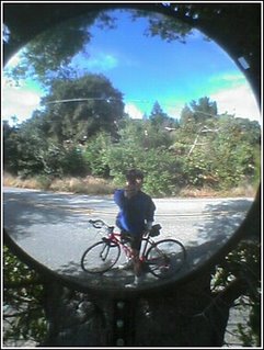
Self-portrait After Davenport, I saw a club rider leading a group of 4 or 5 riders north on Hwy 1. We exchanged greetings. Soon afterwards, I turned left onto Bonny Doon Rd, and initially descended into tree-lined coldness. Once the climbing started, it was still somewhat chilly, due to the tree cover. By the Bonny Doon Winery, I turned left to stay on Bonny Doon Rd. I stopped by a mirror near the upper end of Bonny Doon Rd for a self-portrait.
I continued up Pine Flat and turned left at Empire Grade. I rarely ride this direction on Empire Grade, so I saw things I don't normally see, going slowly at places that normally go by quickly in descent. I also continued beyond Jamison Creek Rd, where I had only ridden once before.
Eagle Rock I stopped by Eagle Rock to take a picture. I then continued up to the Lockheed gate, then turned around and headed back down. I turned right at Ice Cream Grade and took Martin Rd back to Bonny Doon Rd.
At Smith Grade, I turned left. Soon, I was heading down dark, steep, twisty descents. The road was still damp from the rains. Eventually, the trees thinned and it was warm and sunny. However, I hadn't stopped for a break at all, as the only good place for a break was Davenport, and it was too soon then, so I was getting very hungry and weak. In the middle of the final steep climb to Empire Grade, where it flattened out for a while, I stopped and downed a bar. It helped, and I rode home down Empire Grade.